Basic HTML Version


FAR
FLUNG
TRAVEL
by Chuck Graham
TWO WEEKS ON THE RIVER RAPIDS, VAST PLAINS,
AND UNTOUCHED MOUNTAIN TERRAIN
OF ALASKA’S FINAL FRONTIER
I
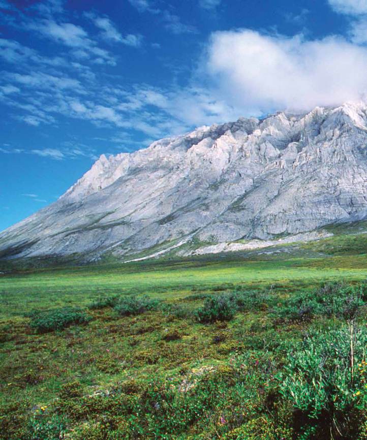
t could’ve been only one animal that nimble on the north slope of the Brooks Range in northeastern Alaska. A Dall sheep ram had hoofed its way out onto
an extremely precarious perch in the shadows of a deep gorge overlooking the upper Marsh Fork River in the Arctic National Wildlife Refuge (ANWR).
While gazing upward, we spun around in our four-person raft, paddling through class III rapids, when we got a great look at North America’s
largest sheep species. Shortly after passing through the gorge, I jumped out of the raft, thrashed through willows teeming with horseflies and mosquitoes,
and worked my way above and behind the stout, cotton-colored sheep. I found an opening at the top of the gorge and scrambled downward within 30 feet
of the ram. He gazed up at me seemingly without worry, then stood up and stretched before traversing back across the cliff to an awaiting ewe.
The Arctic National Wildlife Refuge consists of 19,286,722 acres in the Alaska North Slope region. The expanse is the largest national wildlife refuge
in the country. With friends Truman Boren, Chris van Hook, and Alaskan guide-photographer Carl Donohue, I was in the midst of a two-week, 160-mile
rafting trip, exploring this pristine wilderness, the last five percent of northern Alaska currently not open to oil drilling.
Beyond the upper Marsh Fork, we paddled the Canning and Staines rivers, bouncing off dense gravel bars, ducking beneath spindly willow thickets,
and dodging thick ice packs until we were clear of the Brooks Range. Nothing but flat coastal plain unfolded before us to the Arctic Ocean.
RIVERS FLOW THROUGH IT